AI System for Remote Construction Progress Tracking

AI DevelopmentConstruction

Overview

How Rensai Labs Automated Construction Excavation Monitoring Using AI

  • 50 excavation points – target monitoring coverage for a single site manager
  • 2 months – MVP delivery timeline
  • 280 working hours – total development effort
  • Every 4 hours – planned progress monitoring and notification cycle

Team & Tech Stack

Team

  • Project Manager
  • ML Engineer
  • Fullstack Developer
  • Tech Lead

Technology Stack

  • AI Model: Depth-Anything-V2-Metric-Outdoor-Small-hf
  • Core: Python (ML), JavaScript/TypeScript (Fullstack)
  • Frontend: React
  • Backend: NestJS
  • Database: PostgreSQL

Context

The client is a Finnish technology startup led by experts in engineering and infrastructure innovation. The company focuses on the digitalization of construction project management, where, according to statistics, up to 80% of processes remain inefficient. Having received a university grant, the client concentrated on automating the monitoring of earthworks – one of the most labor-intensive stages in road construction.

Objective

To eliminate manual site verification as a bottleneck to scalability, the startup needed to automate construction monitoring – enabling a single site manager to remotely oversee up to 50 excavation points without physical visits or daily drone launches.

  • Implement an AI-based system capable of automatically determining the depth and stage of completion of excavations.
  • Develop a functional MVP to validate the accuracy of the recognition algorithms as part of the awarded university grant.
  • Create a working Proof of Concept to demonstrate the technology to potential investors.

Methodology

Agile/Kanban – Rensai Labs used a flexible Kanban workflow to adapt quickly to changing requirements and delays in client-provided materials.

Proactive Problem Solving – the team proposed practical workarounds, including a manual photo upload page, to keep validation moving despite limited training data.
Key Business Blockers and Pain Points

The client faced systemic inefficiencies in the monitoring of earthworks – an issue characteristic of the entire construction sector, where up to 80% of processes require optimization.

The need for managers to be physically present on-site to manually launch drones across 50+ excavation points made business growth impossible without proportionally increasing the number of supervisory staff.

Where is your AI project getting stuck – manual oversight, limited training data, or both?

Let’s identify the real bottleneck. Rensai Labs will stress-test your computer vision concept against data, hardware, and site constraints. Then we’ll design the fastest practical path to a working MVP.
30 minutes. No commitment.

Solution

To address the client’s challenges, Rensai Labs designed a cloud-based ecosystem to transform fragmented construction site data into a clear and practical management tool.

To prevent MVP development from stalling due to the lack of real photographs from the client, the Rensai Labs team applied a creative AI training approach. We simulated excavation conditions in an office environment, which allowed us to validate the mathematical depth-recognition model and prepare the product for demonstration precisely on schedule.

Step 1

A strategic decision to implement a manual data upload module enabled the client to demonstrate the system’s logic to investors and prospective customers without waiting for complex integration with cameras at real construction sites.

Step 2

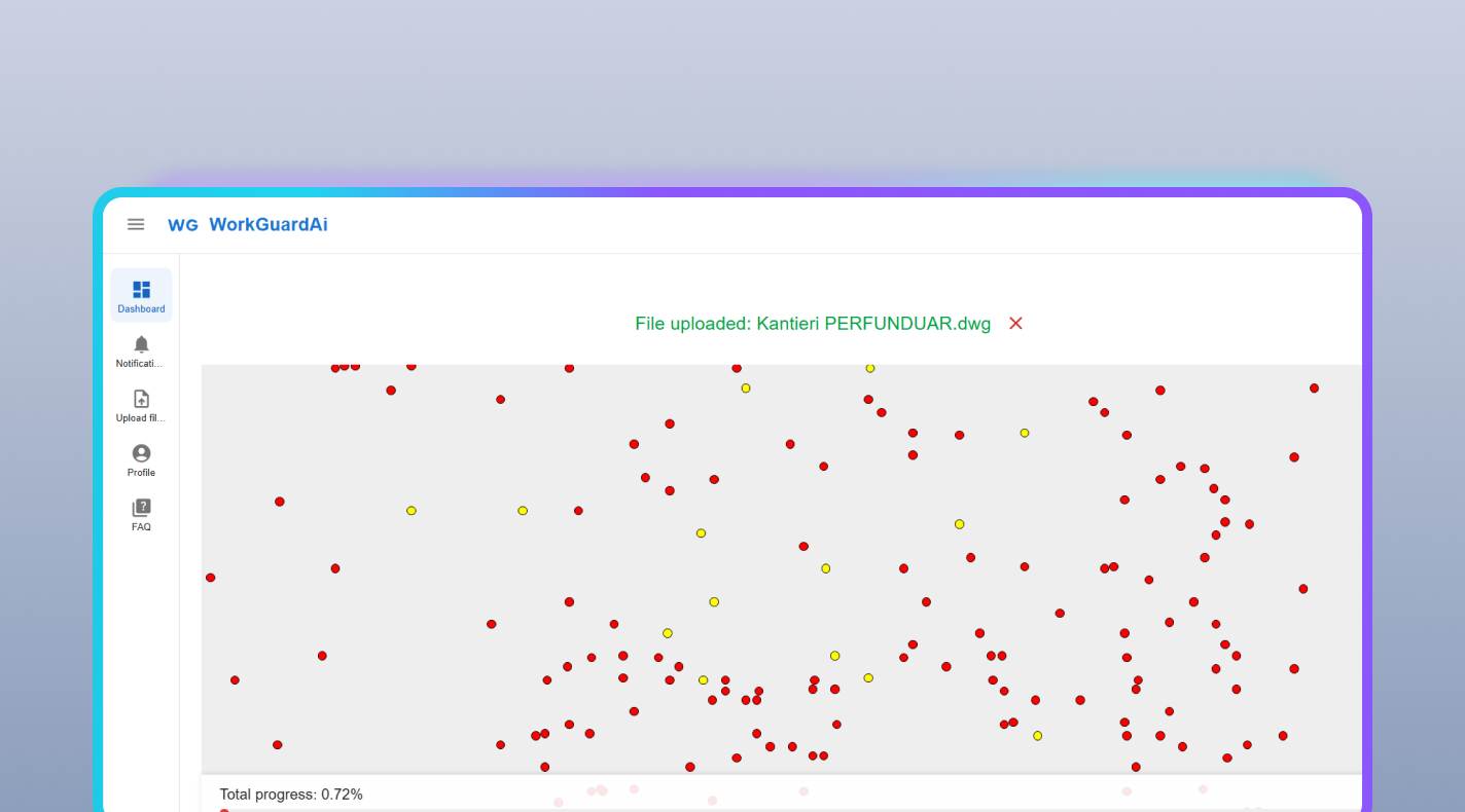
The system consolidated the monitoring of 50 distributed excavation points into a single interface. The use of digital overlays (DWG files) provided site managers with visual context that was previously unavailable when relying solely on standard drone footage.

Step 3

The solution shifted the responsibility for progress analysis from humans to Computer Vision algorithms, ensuring consistent and objective audits of all sites every four hours.

Step 4

Core Features

The platform combines interactive site mapping with AI-based depth analysis and automated notifications.

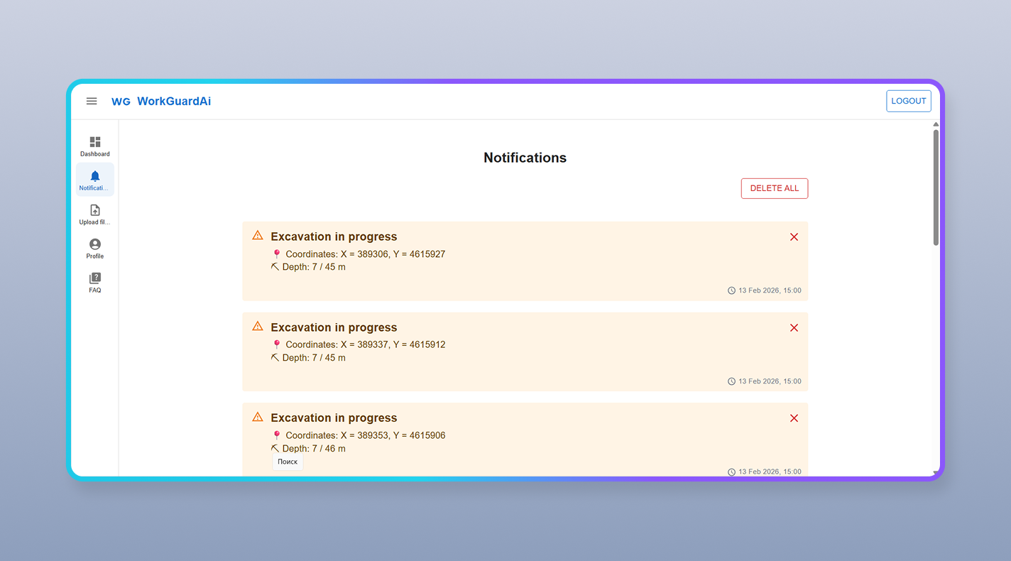
  • Interactive Map (DWG Import) – visualization of all 50 excavation sites with color-coded status indicators and precise coordinates.
  • AI-Based Depth Analysis – intelligent calculation of depth and progress using the Depth-Anything-V2-Metric-Outdoor-Small-hf model.
  • Smart Notification System – in-app and email notifications about any changes on-site every four hours.
  • Demonstration Tool (Manual Upload) – manual upload and instant analysis of photographs for investor demos.

The model generates a depth map of the image and converts it into metric depth, taking into account shooting parameters.

Benefits and Results

MVP development took 280 working hours (2 months), which allowed the client to report on the grant on time and enter the market with a ready technological solution. If one manager previously spent 4 hours traveling between sites and now spends 20 minutes checking the dashboard, this results in savings of 15+ hours per week.

280 hours
MVP development effort in 2 months
Every 4 hours
Automated progress monitoring cycle
15+ hours/week
Saved per site manager vs. manual visits

Your construction operation may be different. The integration problem usually isn’t.

We’ll review your workflows, integration points, and technical constraints, then recommend the most practical path forward.
30-minute call → Free audit → Proposal within 5 days